September [generally] never disappoints from an alpine weather point of view. This year due to the bad weather in July and therefore no "thermo nuclear heated summer". The mountains and glaciers were in an excellent condition.
Charles Sherwood joined me for our annual summer climbing adventure.
Not for the first time we were presented with a poor forecast, at least for the first couple of days. We started with some valley rock climbing in Les Contamines at the La Duchere crag. We climbed a variety of different grade pitches , linked them all together and finished on the strangely named" Le Nain Jaune attends." The Yellow Gnome Awaits. Sure enough, bolted to the top of the crag was a yellow gnome. Just as we got to the top it started to rain heavily.
The next day the forecast was again poor, but with a significantly improving out look. We decided to use the day to get into position and headed off to the Bernese Oberland for a project we had discussed many times before , but had never had the right conditions at the right time.
We stayed the night in Murren which was a nod to a bit of acclimatisation because the village is at 1600meters. Murren amongst other things is famed for its glorious views across to the Eiger Monch and Jungfrau. Non of them revealed themselves to us because it was raining hard and thinking about snowing.
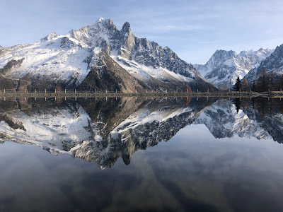
The next morning was different . It was beautiful. We took the train to Kliene Schiedegg. By chance the last time we had been here together was exactly 14 years to the day we climbed the North Face of the Eiger together.
 |
| 11th September 2007 . |
Our ambitions were more modest this time around . We were going to walk down the Aletsch glacier and spend the night in the Konkordia Hutte.
This is excatly what we did, arriving for beers on the finely situated terrace with its view over the Konkordia Platz and far beyond. There is a strangely placed parking meter just below the terrace:
We were also able to book a private room, complete with fresh sheets , bed side tables and lamps and complimentory bottles of water. Probably no bad thing to do in post Covid times , especially because the hut was very busy.
The next day proved to be a big day. We awoke at 3.30hrs had breakfast and then carefully descended the many many metal steps back down to the glacier. Our goal for the day was the Grosses Grunhorn 4044meters. Once at the foot of the stairs, the next challange was to thread our way through the endless moraine which was just like a quarry. It was pitch black and there were no cairns to help us. Next it was onto a dry glacier , so once again no track to follow. There was no way to dress this up it was extremely tedious navigation. Neither were there any other parties to share the tedium with. Yet bit by bit we pieced the route together and it became slightly easier when we had a bit of day light.
It then became absolutely fantastic. Blue skies a good temperature and just a light breeze. There was no one around and we had the sense we were somewhere very special.
We climbed up on to the ridge which forms the Grunegghorn 3862 meters before descending a further tricky [ish] ridge down to the col which seperates the Grosse Grunhorn. From the col the climb to the summit of the Grosses Grunhorn was technically easier. We arrived on the top just before 11.30hrs. There was one other mountaineer- a man who's primary aim seemed to be in the search of solitude. He did say hello but then he immediately descended. After a bite to eat and some photos we too headed on down too. We arrived at the col from where our plan was to turn left and rappel down the cliffs which would lead to the glacier and from there to our bed for the night at the Finnsterahorn Hutte. All quite simple in theory, but not for the first time the reality was not that simple.
Locating the first rappel point was a relief. A big solid metal ring. Perfect . Then 20 meters later there was another. This is going to be quick I naively thought. The next ring was no where to be seen. I had to build an anchor, leave some gear and make a mighty swing to the left [looking down]. The problem was that each anchor instead of being below the next anchor was in fact 10 meters to the the left of the previous one. In effect it was a rappel traverse. This clearly would have been good to know beforehand and we lost time working it all out. Eventually we landed on the glacier and walked down and down until the snow turned to hard glacier ice and then a maze of open crevasses. Once across the glacier it was a short but unwanted climb up the moraine to the welcome beers at the Finsteraarhorn Hutte. Pretty much a twelve hour day. Hard work but magnificient.
The next day we were up at 3.30hrs and away by 4.15hrs. The days objective was the highest mountain in the Bernese Oberland the Finsteraarhorn 4274 metres.
 |
| Finsteraarhorn 4274m seen from the summit of the Grosses Grunhorn. |
Although higher than the previous day, the climb is much more straight forward and the conditions were excellent. We were once again on our own. Our lone climber from the previous day was ahead of us, but he was the only person we got a glimpse of in the last two days. The ascent is straight forward until you arrive at the prominent shoulder . From there you follow a rocky ridge for about an hour until you eventually reach an "overbuilt" giant cross which marks the summit. Mr Solitude was sitting there clearly taking it all in and having his momment.
 |
Charles just about to arrive on the summit.
|
We left Mr Solitude to continue his contemplations and reversed the ridge. It was quite windy and cold. Back at the snowy shoulder we strapped our crampons on and had a bite to eat. We then retraced our line of ascent arriving back at the Hutte for about 13.30hrs. A shorter day than the previous one , but that probably wasn't such a bad thing.
Now the challange of a visit to the Finnsteraarhorn Hutte is leaving it. There are no simple routes to the valley. For a variety of reasons we wanted not just the quickest route to the road head but the quickest route back to Chamonix. I especially wanted to be back for dinner with my daughter Florence who was celebrating her 21st birthday.
The quickest route to the road head was out to the Grimsel Pass. The problem is that, at the road there is no onward transport. I had taken this route a couple of times before once in summer and once on skis in the spring. Next there is the option of descending the Fiescher glacier "eventually" arriving in Fiesch. The guardian and his wife went through the whole descent with us tracing the route out on the map. Global warming has devastated the glacier and the final bit of the journey sounded very complicated. They said it was possible, but it was very long. They didn't exactly sell it to us as a good option, especially since I had never been down this route. Then on overhearing our conversation, a local guide from Feisch said he a come up the Aletch glacier from Fiesch in 7 hours and that we should go back the way he had walked up. Reasonably I thought that if he had come up in 7 hours we could get down a lot in less time. I had done this route on skis in a total white out, so thought this might be our best option. This was what we opted to do. We would walk back over the Grunhornlucke col and descended the glacier until we reached the Alteschglacier. We would then turn left and follow the glacier towards Fiesch.
It was when we arrived at the junction of the Altesch glacier just below the Konkordia Hutte that we had an inkling that our timing was a little awry. Doing everthing right and keeping to a good pace it had already taken us 4 hours and our day was only just starting. A head of us was a labyrinth of crevasses as far as the eye could see. I reflected on the conversation with the Fiesch guide. Either something got lost in translation or he was full of bullshit because it was impossible to see how he had got from Fiesch to the Hutte in 7 hours.
We considered all options - there being the option of walking back up to the Jungfraujoch railway station but Charles was adament he did not want to do that. The estimate for a return would have been at least 4 hours of up hill slog.
So we set off down the glacier. Or to start with, at ninety degrees to straight down because we had to circum-navigate a huge crevasse which blocked our way:
 |
| Setting off at right angles to where we wanted to go. |
It was then back in the opposite direction. After an hour we had probably made about 200 meters progress in the direction we actually wanted to go.
 |
| Crevasse after crevasse. |
And so it went on hour after hour.
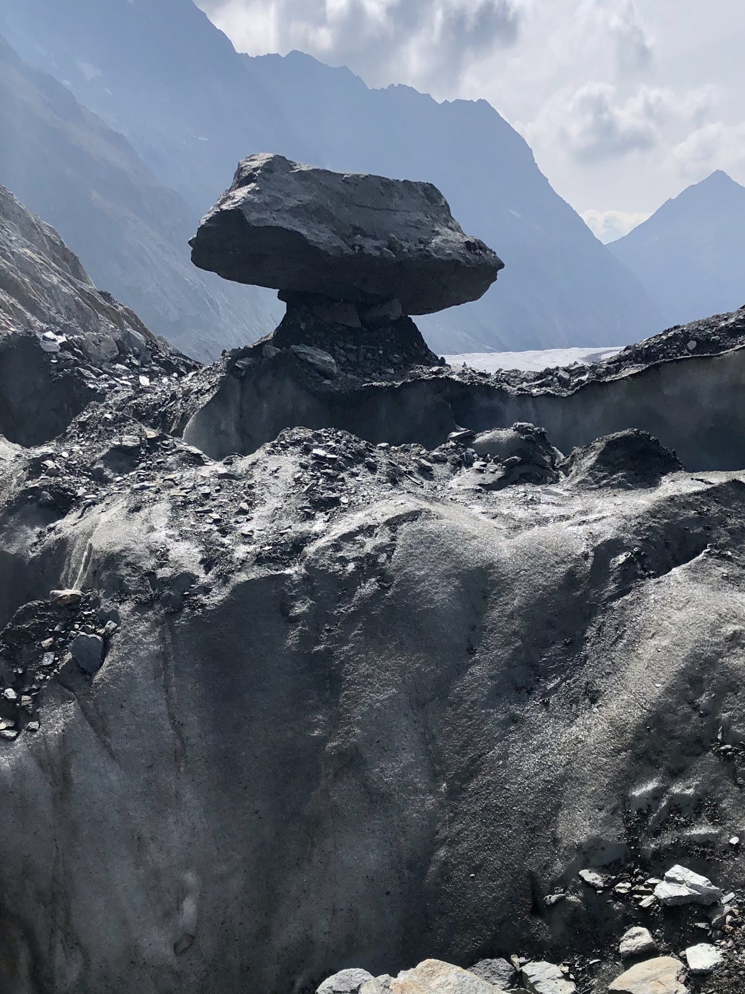
 |
| A glacier table. A glaciologist paradise. |
 |
| WTF. |
Eventually after several hours we came to the exit point from the glacier to the path, where in the space of a few minutes we saw more people than we had in the entire previous 4 days. The path climbs up to a lake, where there is a tunnel through the mounatin side which takes you into the ski resort of Fiesch.
 |
| The tunnel to Fiesch complete with illuminated shrine. |
From there there is a murderous dusty stoney path which leads to the cable car station. The gondola arrives in the railway staion where you can travel all the way back to Lauterbrunnen. Did we make it back for Florences birthday ? Just.
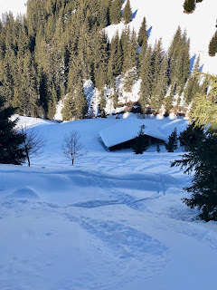
The next day it chucked it down with a dusting of snow in the trees just above our house. The forecast wasn't great for the next day, but after that it was again looking very good. We decided to again use the bad day to walk to a hut. Our plan was to climb the arête de Saille on the Grande Muveran. The first part of the approach uses a chair lift. Sitting on it in the pouring rain, I couldnt help thinking that I had made a bad decision. Yet it stopped raining and the walk to the hut was dry. Delicious food, artisanal beer and good wine, plus our own dormitory was waiting for us.
We left the hut in the dark at about 5.30hrs. The first twenty minutes is on the path and descends the way we had come up the previous afternoon. But it then veers off to the right and is impossible to find the track in the dark. We decided to stop a bit and wait for some proper day light. We were treated to a beautiful sunrise looking over the Rhone valley.
Followed by more spectacular scenes.
After about an hour since leaving the Cabane we arrived at the foot of the climb.
 |
| Arete de Saille |
The first few pitches were very wet after the previous two days of rain. But as the sun dried out the rock and the climbing was good. The higher up you go the better it becomes and the pitch which preceeds the final one is as spectacular any.

The positions and views are marvellous.
Once the hard climbing is over there is still a considerable distance a long the ridge, which is far from simple, with huge exposure especially on the western side.
We gained the summit at about 13.00hrs. Again there was only one other person on the summit but this time he was with his Scotty dog. They had come up via the normal route.
 |
| Summit of Le Grand Muveran. |
The descent back to the Cabane took about an hour and quarter. As an ascent it is unremarkable other than a fabulous view. A quick drink and then we walked back to the top of the chair lift.